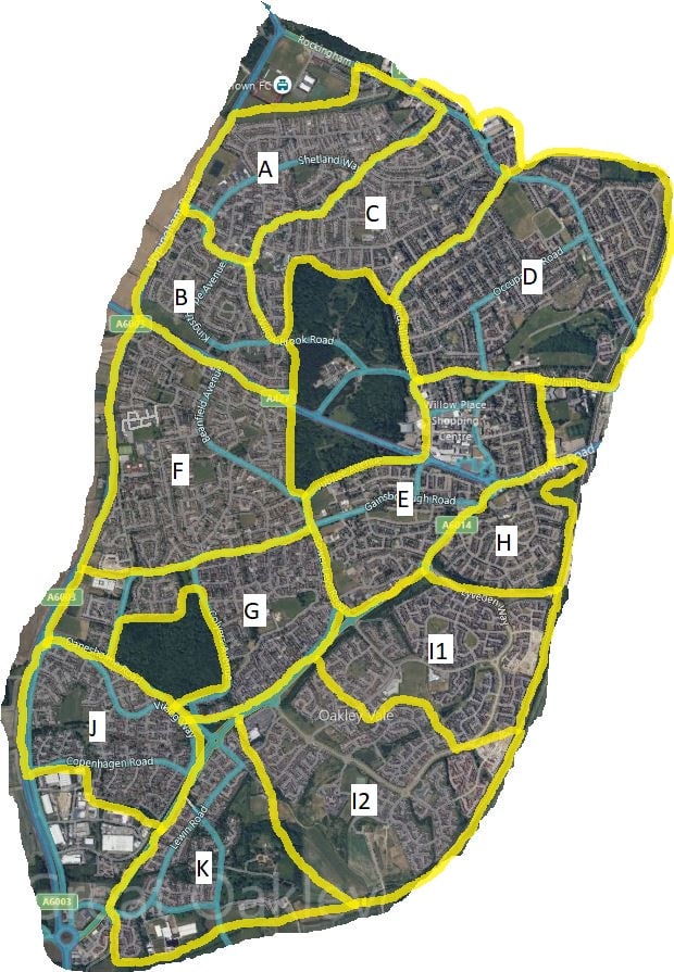
Just choose which areas of Corby you require for GPS leaflet distribution and call us to book your next delivery drop.
The total area count for Corby is approximately 24,500 (includes Priors Hall Park).
Local Leaflet Drop is a trading name of Local Leaflet Drop Ltd | Registered Address: 16 Windsor Drive, Thrapston, Kettering, Northamptonshire, NN14 4XH | Registered in England: 08967249
Kettering – Wellingborough – Rushden – Higham Ferrers – Corby – Northampton – Oundle – Weldon – Stanion – Barton Seagrave – Burton Latimer – Thrapston – Islip – Lowick – Slipton – Twywell – Woodford – Titchmarsh – Denford – Ringstead – Great Addington – Little Addington – Clopton – Wigsthorpe – Lilford – Pilton – Wadenhoe – Achurch – Thorpe Waterville – Aldwincle – Sudborough – Brigstock – Grafton Underwood – Geddington – Rothwell – Desborough – Broughton – Pytchley – Mawsley – Raunds – Chelveston – Stanwick – Irthlingborough – Finedon – in Northamptonshire